1978 Map of Tepee Butte
USGS Topo · Published 1978About this map
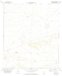
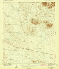
Tepee Butte rises as the central landmark of this high-desert ranching landscape in western Texas during the late 1970s. The region is defined by an intricate network of water management features, critical for sustaining life in this arid terrain. A series of catchment basins and water sources, such as Ventura Tank, Charco Tank, and Santiago Tank, are distributed across the land, connected by the seasonal drainages of Number 9 Draw and Antelope Draw. Modern infrastructure of the era is evident in the presence of a Pumping Sta and a Radio Tower, reflecting the technological adaptations required to manage remote Hudspeth County holdings. The prevalence of private tracks and isolated tanks suggests a landscape focused on cattle ranching, where every named water source like New Tank serves as a vital point of reference for land use and navigation.
Find a feature on this map
13 named features on this map. Tap any name to fly to it.
Don’t see what you’re looking for? This feature index may not catch every label — zoom into the map to look around manually.
Map Details
Editions of this 1978 Tepee Butte Map
This is the sole edition of this map. No revisions or reprints were ever made.
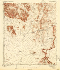
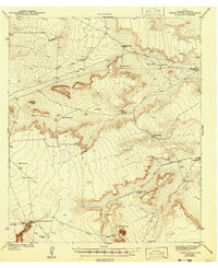
Other maps of this area

1903 · Cerro Alto
USGS Topo · 1:125,000
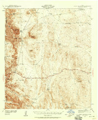
1941 · Heuco Mountains
USGS Topo · 1:62,500
1942 · Borrego
USGS Topo · 1:62,500
1943 · Tepee Butte
USGS Topo · 1:62,500
1943 · San Antonio Mtn
USGS Topo · 1:62,500

1943 · Heuco Mountains
USGS Topo · 1:62,500

1954 · Van Horn
USGS Topo · 1:250,000

1958 · Van Horn
USGS Topo · 1:250,000
1977 · Whiterock Hills
USGS Topo · 1:24,000
1978 · Granite Mountain
USGS Topo · 1:24,000