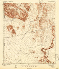
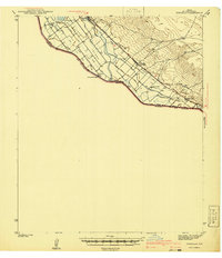
1942 Map of Borrego
USGS Topo · Published 1942About this map
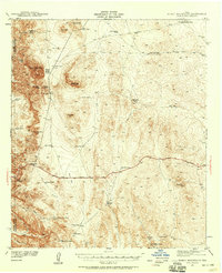
The Finlay Mountains dominate this 1940s landscape on the border of El Paso and Hudspeth counties, providing a window into the hardscrabble ranching and mining efforts of the era. Water sources are the defining features of this arid terrain, with numerous man-made and natural features like Minnie Veale Well, Indian Well, and Shakespeare Tank scattered throughout the basins and draws. The existence of the Old Padre Mine near the western foothills suggests the localized extraction efforts that once dotted this region. A massive Rimrock wall and the Watershed Divide provide clear topographical boundaries across the eastern half of the map, while intermittent drainages like Borrego Draw and Wildhorse Draw carve paths through the scrub. This survey captures a moment when local ranching infrastructure was primary to the region's survival.
Find a feature on this map
23 named features on this map. Tap any name to fly to it.
Don’t see what you’re looking for? This feature index may not catch every label — zoom into the map to look around manually.
Map Details
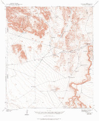
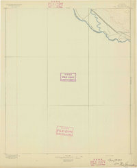
Editions of this 1942 Borrego Map
3 editions found

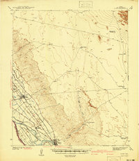
Other maps of this area

1894 · Fort Hancock
USGS Topo · 1:125,000

1896 · El Paso
USGS Topo · 1:125,000
1896 · Rio Grande
USGS Topo · 1:125,000

1903 · Cerro Alto
USGS Topo · 1:125,000

1908 · El Paso
USGS Topo · 1:125,000

1939 · Heuco Tanks
USGS Topo · 1:62,500

1940 · Heuco Tanks
USGS Topo · 1:62,500
1941 · Clint
USGS Topo · 1:62,500
1941 · Tornillo
USGS Topo · 1:62,500
1941 · Heuco Mountains
USGS Topo · 1:62,500