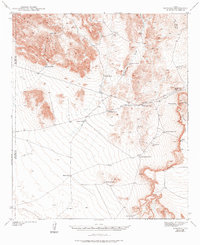
1942 Map of Borrego
USGS Topo · Published 1976About this map
The Hueco Mountains dominate the northwestern corner of this West Texas landscape, where the arid environment necessitated an intricate network of water catchments and wells. Surveyed in 1940, the map documents the survival of ranching and prospecting infrastructure, most notably the Old Padre Mine situated near the head of Padre Canyon. The reliance on surface water is evident through the numerous named depressions like Quail Tank and Boulder Tank, while deeper resources were tapped at Minnie Veale Well and TP Well.
Find a feature on this map
28 named features on this map. Tap any name to fly to it.
Don’t see what you’re looking for? This feature index may not catch every label — zoom into the map to look around manually.
Map Details
Editions of this 1942 Borrego Map
3 editions found

Other maps of this area

1894 · Fort Hancock
USGS Topo · 1:125,000

1896 · El Paso
USGS Topo · 1:125,000

1896 · Rio Grande
USGS Topo · 1:125,000

1903 · Cerro Alto
USGS Topo · 1:125,000

1908 · El Paso
USGS Topo · 1:125,000

1939 · Heuco Tanks
USGS Topo · 1:62,500

1940 · Heuco Tanks
USGS Topo · 1:62,500

1941 · Clint
USGS Topo · 1:62,500

1941 · Tornillo
USGS Topo · 1:62,500

1941 · Heuco Mountains
USGS Topo · 1:62,500