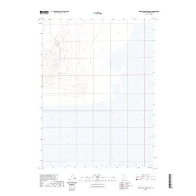
2023 Map of Terrace Mountain East
USGS Topo · Published 2023About this map
Terrace Mtn dominates this arid landscape in the eastern Great Basin, its topographic contours revealing the stark relief of a Great Salt Lake desert range. This 2023 edition shows the mountain's southeastern slopes and the expansive alkali flats that stretch away to the south and east. A single transit route, Terrace Mountain Rd, skirts the northern foothills of the mountain, providing the only established access through this unpopulated terrain. The map meticulously documents the shoreline transition between the solid ground of the mountain base and the surrounding seasonal wetlands or salt crusts of the desert floor, as captured in modern digital surveys by the U.S. Geological Survey.
Find a feature on this map
2 named features on this map. Tap any name to fly to it.
Don’t see what you’re looking for? This feature index may not catch every label — zoom into the map to look around manually.
Map Details
Editions of this 2023 Terrace Mountain East Map
This is the sole edition of this map. No revisions or reprints were ever made.
Other maps of this area

1954 · Brigham City
USGS Topo · 1:250,000

1958 · Brigham City
USGS Topo · 1:250,000

1962 · Brigham City
USGS Topo · 1:250,000

1971 · Prohibition Spring
USGS Topo · 1:24,000

1971 · Red Dome
USGS Topo · 1:24,000

1971 · Matlin
USGS Topo · 1:24,000

1983 · Lemay
USGS Topo · 1:24,000

1983 · Bovine SE
USGS Topo · 1:24,000

1983 · Terrace Mountain West
USGS Topo · 1:24,000

1983 · Terrace Mountain East
USGS Topo · 1:24,000