
1983 Map of Bovine SE
USGS Topo · Published 1983About this map
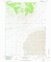
The Southern Pacific railroad line cuts a straight, horizontal path across this arid landscape in Box Elder County, Utah. This 1983 orthophotomap combines aerial photography with topographic data to show a region dominated by an expansive Mud Flat, where the shifting textures of the desert floor are visible in detail. Water management is a central theme of this remote sector, evidenced by the presence of a prominent Aqueduct running north-south along the eastern edge and several Flowing Wells located near the southern boundary. These features suggest a localized reliance on groundwater and engineering to navigate the high desert environment. The terrain is largely undeveloped, with a few Private access roads providing the only terrestrial connections through the wash-marked salt flats and basins.
Find a feature on this map
6 named features on this map. Tap any name to fly to it.
Don’t see what you’re looking for? This feature index may not catch every label — zoom into the map to look around manually.
Map Details
Editions of this 1983 Bovine SE Map
This is the sole edition of this map. No revisions or reprints were ever made.
Other maps of this area

1954 · Brigham City
USGS Topo · 1:250,000

1958 · Brigham City
USGS Topo · 1:250,000

1962 · Brigham City
USGS Topo · 1:250,000

1983 · Jackson
USGS Topo · 1:24,000

1983 · Lemay
USGS Topo · 1:24,000

1983 · Terrace Mountain West
USGS Topo · 1:24,000

1983 · Terrace Mountain East
USGS Topo · 1:24,000

1983 · Lucin 4 NE
USGS Topo · 1:24,000
1983 · Bovine
USGS Topo · 1:24,000
1983 · Miners Basin
USGS Topo · 1:24,000