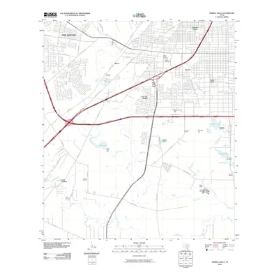
2010 Map of Terrell Wells
USGS Topo · Published 2010About this map
Leon Creek and the Medina River define the lower basin of the San Antonio suburbs in this early 21st-century record. The map reveals a transition from dense residential grids in Columbia Heights and Terrell Wells to industrial and water management infrastructure further south. This includes the massive Leon Creek Water Resources Complex and the industrial corridors following Quintana Rd and the New Laredo Hwy.
Find a feature on this map
60 named features on this map. Tap any name to fly to it.
Don’t see what you’re looking for? This feature index may not catch every label — zoom into the map to look around manually.
Map Details
Editions of this 2010 Terrell Wells Map
This is the sole edition of this map. No revisions or reprints were ever made.
Other maps of this area

1953 · Culebra Hill
USGS Topo · 1:24,000

1953 · San Antonio West
USGS Topo · 1:24,000

1953 · San Antonio East
USGS Topo · 1:24,000

1953 · Terrell Wells
USGS Topo · 1:24,000

1953 · Macdona
USGS Topo · 1:24,000

1953 · Southton
USGS Topo · 1:24,000

1954 · San Antonio
USGS Topo · 1:250,000

1957 · San Antonio
USGS Topo · 1:250,000

1958 · Losoya
USGS Topo · 1:24,000

1958 · Somerset
USGS Topo · 1:24,000