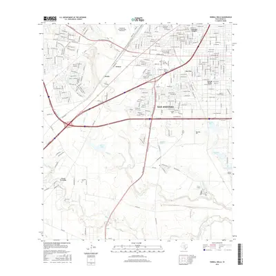
2016 Map of Terrell Wells
USGS Topo · Published 2016About this map
Lackland Air Force Base (Kelly Field Annex) and the Baptist Univ of the Americas anchor the northern landscape of this San Antonio quadrant, where urban expansion meets the historic river bottoms of the south. The transition from the dense street grids of Columbia Heights and San Jose into the open terrain near the Medina River reveals the enduring footprint of rural Bexar County. Genealogists and local historians can locate several family and community landmarks, including the Lona China Cem, Hernandez Cem, and Ruiz Cem. Water remains a defining element of the local geography, from the sprawling Mitchell Lake and Canvasback Lake to the confluence of Leon Cr and Medio Cr. The map also documents the industrial and transit infrastructure of the era, such as the BNSF Railway and the campus of Palo Alto Coll near the intersection of major southwest thoroughfares.
Find a feature on this map
117 named features on this map. Tap any name to fly to it.
Don’t see what you’re looking for? This feature index may not catch every label — zoom into the map to look around manually.
Map Details
Editions of this 2016 Terrell Wells Map
This is the sole edition of this map. No revisions or reprints were ever made.
Other maps of this area

1953 · Culebra Hill
USGS Topo · 1:24,000

1953 · San Antonio West
USGS Topo · 1:24,000

1953 · San Antonio East
USGS Topo · 1:24,000

1953 · Terrell Wells
USGS Topo · 1:24,000

1953 · Macdona
USGS Topo · 1:24,000

1953 · Southton
USGS Topo · 1:24,000

1954 · San Antonio
USGS Topo · 1:250,000

1957 · San Antonio
USGS Topo · 1:250,000

1958 · Losoya
USGS Topo · 1:24,000

1958 · Somerset
USGS Topo · 1:24,000