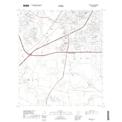
2019 Map of Terrell Wells
USGS Topo · Published 2019About this map
San Antonio's southern landscape is defined by the convergence of major waterways and expanding residential districts. The Medina River and its tributaries, including Leon Cr and Indian Cr, carve through the terrain south of SW Loop 410. This area reveals a transition from the dense urban grid of neighborhoods like Columbia Heights and Terrell Wells in the north to the more open, riparian corridors of the river valley. Notable landmarks such as Kelly Field and Horizon Airport highlight the region's aviation ties, while family-named sites like Hernandez Cem and Rutz Cem provide essential data for local historians. The presence of Garza Crossing near the confluence of the river and Medina River Trail illustrates the long-standing importance of this water network to the area's movement and development.
Find a feature on this map
36 named features on this map. Tap any name to fly to it.
Don’t see what you’re looking for? This feature index may not catch every label — zoom into the map to look around manually.
Map Details
Editions of this 2019 Terrell Wells Map
This is the sole edition of this map. No revisions or reprints were ever made.
Other maps of this area

1953 · Culebra Hill
USGS Topo · 1:24,000

1953 · San Antonio West
USGS Topo · 1:24,000

1953 · San Antonio East
USGS Topo · 1:24,000

1953 · Terrell Wells
USGS Topo · 1:24,000

1953 · Macdona
USGS Topo · 1:24,000

1953 · Southton
USGS Topo · 1:24,000

1954 · San Antonio
USGS Topo · 1:250,000

1957 · San Antonio
USGS Topo · 1:250,000

1958 · Losoya
USGS Topo · 1:24,000

1958 · Somerset
USGS Topo · 1:24,000