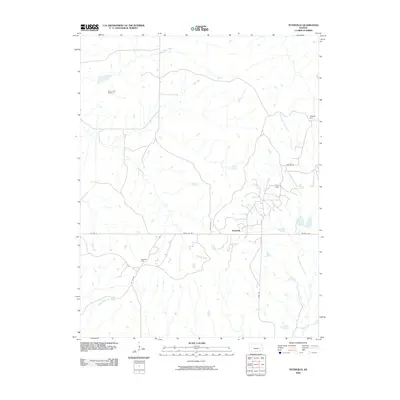
2009 Map of Teterville
USGS Topo · Published 2009About this map
Teterville sits at the heart of this central Kansas landscape, where the agricultural plains meet the industrial footprint of the regional energy sector. The layout of the land is defined by the headwaters of the Fall River, with both the West Branch Fall River and East Branch Fall River carving through the terrain alongside Thurman Creek. This 2009 survey highlights a rural environment where oil production remains a significant presence, evidenced by the Scott Oil Field and the Teter Oil Field. Cultural and historical markers, such as the High Prairie Cemetery and the prominent Texaco Hill, provide essential points of reference for genealogists and local historians tracking the families and industries that shaped this corner of Greenwood County. The grid of township roads, including Teter Hill Rd and River Rd, connects these remote work sites and landmarks across the tallgrass prairie.
Find a feature on this map
16 named features on this map. Tap any name to fly to it.
Don’t see what you’re looking for? This feature index may not catch every label — zoom into the map to look around manually.
Map Details
Editions of this 2009 Teterville Map
This is the sole edition of this map. No revisions or reprints were ever made.
Other maps of this area

1885 · Eureka
USGS Topo · 1:125,000

1888 · Emporia
USGS Topo · 1:125,000

1888 · Eureka
USGS Topo · 1:125,000

1888 · Eldorado
USGS Topo · 1:125,000

1894 · Emporia
USGS Topo · 1:125,000

1894 · Eureka
USGS Topo · 1:125,000

1898 · Cottonwood Falls
USGS Topo · 1:125,000

1955 · Wichita
USGS Topo · 1:250,000

1955 · Hutchinson
USGS Topo · 1:250,000

1958 · Wichita
USGS Topo · 1:250,000