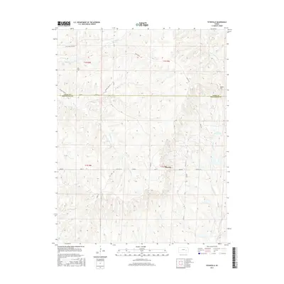
2015 Map of Teterville
USGS Topo · Published 2015About this map
Teterville sits at the heart of this landscape where the headwaters of several Kansas river systems begin their descent. The terrain is defined by the divides between the N Br Verdigris River to the northeast and the multiple forks of the Fall River. Local history is anchored by the High Prairie Cem in the northwest, while the energy industry's footprint on the land is visible through landmarks like Texaco Hill and Cities Service Lake. The road network, including Teter Hill Rd and Thurman Creek Rd, follows the high ridges and valley floors, tracing the natural drainage patterns of Thurman Cr and Little Cedar Cr. This survey illustrates the rural character of the Greenwood Co and Chase Co border, where land use is dictated by the deeply dissected topography of the Kansas Flint Hills region.
Find a feature on this map
28 named features on this map. Tap any name to fly to it.
Don’t see what you’re looking for? This feature index may not catch every label — zoom into the map to look around manually.
Map Details
Editions of this 2015 Teterville Map
This is the sole edition of this map. No revisions or reprints were ever made.
Other maps of this area

1885 · Eureka
USGS Topo · 1:125,000

1888 · Emporia
USGS Topo · 1:125,000

1888 · Eureka
USGS Topo · 1:125,000

1888 · Eldorado
USGS Topo · 1:125,000

1894 · Emporia
USGS Topo · 1:125,000

1894 · Eureka
USGS Topo · 1:125,000

1898 · Cottonwood Falls
USGS Topo · 1:125,000

1955 · Wichita
USGS Topo · 1:250,000

1955 · Hutchinson
USGS Topo · 1:250,000

1958 · Wichita
USGS Topo · 1:250,000