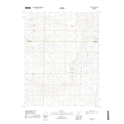
2018 Map of Teterville
USGS Topo · Published 2018About this map
The community of Teterville sits at the heart of this Flint Hills landscape where the headwaters of several major Kansas river systems begin their journey. The terrain is marked by significant topographical relief, notably at Texaco Hill and across the drainage divides between the N Br Verdigris River and the branches of the Fall River. This area serves as a primary watershed, with Little Cedar Cr and Thurman Cr carving through the limestone-underlaid prairies. Local genealogy and settlement history are centered around the High Prairie Cem in the northwest, while the industrial and agricultural history of the region is reflected in features like Cities Service Lake and the network of section-line roads such as Teter Hill Rd and Madison Rd. The map also captures the administrative boundary between Chase Co and Greenwood Co.
Find a feature on this map
29 named features on this map. Tap any name to fly to it.
Don’t see what you’re looking for? This feature index may not catch every label — zoom into the map to look around manually.
Map Details
Editions of this 2018 Teterville Map
This is the sole edition of this map. No revisions or reprints were ever made.
Other maps of this area

1885 · Eureka
USGS Topo · 1:125,000

1888 · Emporia
USGS Topo · 1:125,000

1888 · Eureka
USGS Topo · 1:125,000

1888 · Eldorado
USGS Topo · 1:125,000

1894 · Emporia
USGS Topo · 1:125,000

1894 · Eureka
USGS Topo · 1:125,000

1898 · Cottonwood Falls
USGS Topo · 1:125,000

1955 · Wichita
USGS Topo · 1:250,000

1955 · Hutchinson
USGS Topo · 1:250,000

1958 · Wichita
USGS Topo · 1:250,000