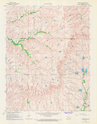
1967 Map of Teterville
USGS Topo · Published 1968About this map
The Salem township of Greenwood County reveals a landscape defined by mid-century energy production and ranching as recorded in the late 1960s. Oil Wells and a complex network of pipelines crisscross the drainage of the East Branch River, indicating the significant petroleum activity surrounding the settlement of Teterville. This remote community and its associated industrial infrastructure, including the Cities Service Lake and a Radio Tower, sit at the intersection of energy development and the natural watercourses that feed the Flint Hills region.
Find a feature on this map
15 named features on this map. Tap any name to fly to it.
Don’t see what you’re looking for? This feature index may not catch every label — zoom into the map to look around manually.
Map Details
Editions of this 1967 Teterville Map
This is the sole edition of this map. No revisions or reprints were ever made.
Other maps of this area

1885 · Eureka
USGS Topo · 1:125,000

1888 · Emporia
USGS Topo · 1:125,000

1888 · Eureka
USGS Topo · 1:125,000

1888 · Eldorado
USGS Topo · 1:125,000

1894 · Emporia
USGS Topo · 1:125,000

1894 · Eureka
USGS Topo · 1:125,000

1898 · Cottonwood Falls
USGS Topo · 1:125,000

1955 · Wichita
USGS Topo · 1:250,000

1955 · Hutchinson
USGS Topo · 1:250,000

1958 · Wichita
USGS Topo · 1:250,000