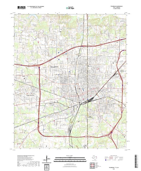
2022 Map of Texarkana
USGS Topo · Published 2022About this map
Texarkana straddles the boundary between Texas and Arkansas, where the interstate corridor and the historic Texas and Pacific RR converge. This 2022 survey documents the urban fabric of a twin-city hub, anchored by civic landmarks like the Miller County Courthouse and educational institutions including Texas A & M University - Texarkana and Texarkana College. The landscape is notably defined by a high density of memorial sites, ranging from the central State Line Cem and Rose Hill Cem to the outlying Moores Chapel Cem and Eylau Cem. To the west, the residential growth of Wake Village and Nash meets the drainage of Howard Cr and Corral Cr, while the eastern side is dominated by the industrial and aviation infrastructure of the Texarkana Regional Airport-Webb Field. The mapping of South Texarkana and the Eylau community provides a detailed record of the region’s suburban expansion and its complex network of local roads and water bodies like Mitchell Lake.
Find a feature on this map
128 named features on this map. Tap any name to fly to it.
Don’t see what you’re looking for? This feature index may not catch every label — zoom into the map to look around manually.
Map Details
Editions of this 2022 Texarkana Map
This is the sole edition of this map. No revisions or reprints were ever made.
Other maps of this area

1909 · Texarkana
USGS Topo · 1:62,500

1950 · Ogden
USGS Topo · 1:24,000

1950 · Barkman
USGS Topo · 1:24,000

1951 · Ogden
USGS Topo · 1:24,000

1951 · Barkman
USGS Topo · 1:24,000

1951 · Homan
USGS Topo · 1:24,000

1952 · Mandeville
USGS Topo · 1:24,000

1952 · Fouke
USGS Topo · 1:24,000

1953 · Texarkana
USGS Topo · 1:250,000

1953 · El Dorado
USGS Topo · 1:250,000