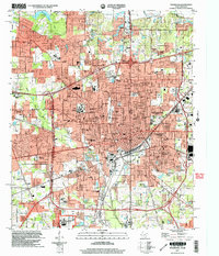
2001 Map of Texarkana
USGS Topo · Published 2004About this map
Texarkana straddles the state line at the turn of the 21st century, revealing a dense urban core shaped by its unique dual-state geography. The map emphasizes the city's role as a regional institutional hub, featuring prominent landmarks like the Federal Correctional Institution to the south and the St Louis Southwestern Railway Hospital near the rail yards. The transportation network is dominated by a complex web of tracks and major thoroughfares such as New Boston Road and Summerhill Road, which facilitate movement between the Texas and Arkansas sides of the city.
Find a feature on this map
95 named features on this map. Tap any name to fly to it.
Don’t see what you’re looking for? This feature index may not catch every label — zoom into the map to look around manually.
Map Details
Editions of this 2001 Texarkana Map
This is the sole edition of this map. No revisions or reprints were ever made.
Other maps of this area

1909 · Texarkana
USGS Topo · 1:62,500

1950 · Ogden
USGS Topo · 1:24,000

1950 · Barkman
USGS Topo · 1:24,000

1951 · Ogden
USGS Topo · 1:24,000

1951 · Barkman
USGS Topo · 1:24,000

1951 · Homan
USGS Topo · 1:24,000

1952 · Mandeville
USGS Topo · 1:24,000

1952 · Fouke
USGS Topo · 1:24,000

1953 · Texarkana
USGS Topo · 1:250,000

1953 · El Dorado
USGS Topo · 1:250,000