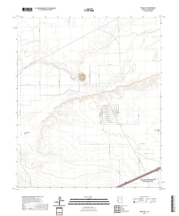
2021 Map of Texas Hill
USGS Topo · Published 2021About this map
Texas Hill rises above the arid plains of Yuma County, providing a prominent landmark within the expansive San Cristobal Valley. This desert landscape is defined by the ephemeral passage of the Gila River and the broad drainage of the San Cristobal Wash. The settlement pattern here is characterized by a concentrated grid of streets with Spanish names, including Cll San Luis and Cll Nogales, clustered near the intersection of El Camino De Sol. To the southeast, the small siding or stop at Stoval sits along a major transportation corridor. The mapping of irrigation infrastructure, such as Canal Rd, indicates the ongoing efforts to manage water in this dry environment, while the surrounding township and range lines like t7s r14w organize the desert floor for agricultural and land-management use.
Find a feature on this map
47 named features on this map. Tap any name to fly to it.
Don’t see what you’re looking for? This feature index may not catch every label — zoom into the map to look around manually.
Map Details
Editions of this 2021 Texas Hill Map
This is the sole edition of this map. No revisions or reprints were ever made.
Other maps of this area

1926 · Mohawk
USGS Topo · 1:62,500

1927 · Kim
USGS Topo · 1:62,500

1928 · Mohawk
USGS Topo · 1:62,500

1928 · Norton
USGS Topo · 1:62,500

1929 · Norton
USGS Topo · 1:62,500

1930 · Stoval
USGS Topo · 1:62,500

1931 · Kim
USGS Topo · 1:62,500

1950 · Stoval
USGS Topo · 1:62,500

1953 · Ajo
USGS Topo · 1:250,000

1955 · Growler
USGS Topo · 1:24,000