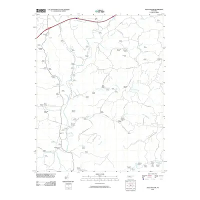
2010 Map of Texas Hollow
USGS Topo · Published 2010About this map
The Piney River carves a deep path through the Western Highland Rim in this Tennessee landscape, where the terrain is defined by a dense network of named hollows and ridges. Settlements such as Cedar Hill and Brown Switch are connected by a web of local routes like Pinewood Rd and Buckner Ridge Rd. The map reveals a high concentration of family-named burial grounds, including the Meacham Cemetery, Wells Cemetery, and Chappell Cemetery, suggesting a deeply rooted local genealogy.
Find a feature on this map
116 named features on this map. Tap any name to fly to it.
Don’t see what you’re looking for? This feature index may not catch every label — zoom into the map to look around manually.
Map Details
Editions of this 2010 Texas Hollow Map
This is the sole edition of this map. No revisions or reprints were ever made.
Other maps of this area

1901 · Colombia
USGS Topo · 1:125,000

1936 · Nunnelly
USGS Topo · 1:24,000

1936 · Whitfield
USGS Topo · 1:24,000

1936 · Littlelot
USGS Topo · 1:24,000

1936 · Texas Hollow
USGS Topo · 1:24,000

1936 · Spot
USGS Topo · 1:24,000

1936 · Burns
USGS Topo · 1:24,000

1936 · Lyles
USGS Topo · 1:24,000

1936 · Tennessee City
USGS Topo · 1:24,000

1936 · Dickson
USGS Topo · 1:24,000