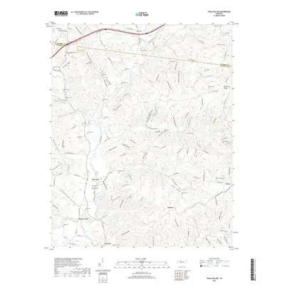
2019 Map of Texas Hollow
USGS Topo · Published 2019About this map
Piney River meanders through a landscape defined by deep valleys and high ridges along the border of Dickson and Hickman counties. Small settlements like Pinewood and Graham serve as focal points in a region characterized by numerous named hollows, including Texas Hollow, Kansas Hollow, and Boneyard Hollow. The distribution of family-named cemeteries such as Bruce Cem, Dodd Cem, and Shipp Cem suggests a long history of family homesteads scattered throughout the wooded terrain.
Find a feature on this map
153 named features on this map. Tap any name to fly to it.
Don’t see what you’re looking for? This feature index may not catch every label — zoom into the map to look around manually.
Map Details
Editions of this 2019 Texas Hollow Map
This is the sole edition of this map. No revisions or reprints were ever made.
Other maps of this area

1901 · Colombia
USGS Topo · 1:125,000

1936 · Nunnelly
USGS Topo · 1:24,000

1936 · Whitfield
USGS Topo · 1:24,000

1936 · Littlelot
USGS Topo · 1:24,000

1936 · Texas Hollow
USGS Topo · 1:24,000

1936 · Spot
USGS Topo · 1:24,000

1936 · Burns
USGS Topo · 1:24,000

1936 · Lyles
USGS Topo · 1:24,000

1936 · Tennessee City
USGS Topo · 1:24,000

1936 · Dickson
USGS Topo · 1:24,000