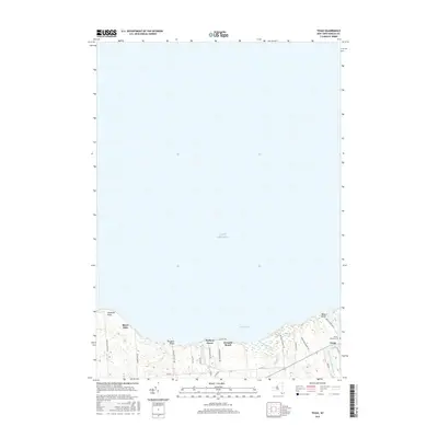
2016 Map of Texas
USGS Topo · Published 2016About this map
The Lake Ontario shoreline in Oswego County defines this 2016 survey, showing a series of lakeside communities and wetlands tucked behind the beaches. The small settlement of Texas sits inland from Mexico Point, near where the Little Salmon River meets the Great Lake. Local genealogy is anchored by the Parker-Ramsey Cem, located just east of the village. The landscape is characterized by its numerous small waterways and drainage patterns, including Butterfly Creek and the adjacent Butterfly Swamp. Several distinct residential clusters and seasonal landings dot the coast, such as Shore Oaks, Pleasant Point, Hickory Grove, and Demster Beach. These areas are connected by a network of county roads including Co Rte 1 and Co Rte 6, which serve the various points and bays along the Mexico Bay frontage.
Find a feature on this map
33 named features on this map. Tap any name to fly to it.
Don’t see what you’re looking for? This feature index may not catch every label — zoom into the map to look around manually.
Map Details
Editions of this 2016 Texas Map
This is the sole edition of this map. No revisions or reprints were ever made.
Other maps of this area

1895 · Pulaski
USGS Topo · 1:62,500

1900 · Fulton
USGS Topo · 1:62,500

1905 · Mexico
USGS Topo · 1:62,500

1943 · Pulaski
USGS Topo · 1:31,680

1943 · Oswego East
USGS Topo · 1:31,680

1943 · New Haven
USGS Topo · 1:31,680

1943 · Texas
USGS Topo · 1:31,680

1943 · Mexico
USGS Topo · 1:31,680
1943 · Ellisburg
USGS Topo · 1:31,680

1943 · West Of Texas
USGS Topo · 1:31,680