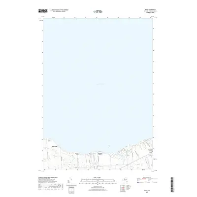
2019 Map of Texas
USGS Topo · Published 2019About this map
Lake Ontario dominates the northern expanse of this survey, defining a coastline shaped by dramatic headlands and seasonal settlements. The shoreline transitions from the industrial proximity of Ninemile Point in the west through a series of lakefront communities, including Shore Oaks, Hickory Grove, and Demster Beach. These areas are characterized by a dense network of short, coastal access roads like Hickory Grove Dr and Dempster Beach Dr, reflecting the area's development as a waterfront retreat.
Find a feature on this map
33 named features on this map. Tap any name to fly to it.
Don’t see what you’re looking for? This feature index may not catch every label — zoom into the map to look around manually.
Map Details
Editions of this 2019 Texas Map
This is the sole edition of this map. No revisions or reprints were ever made.
Other maps of this area

1895 · Pulaski
USGS Topo · 1:62,500

1900 · Fulton
USGS Topo · 1:62,500

1905 · Mexico
USGS Topo · 1:62,500

1943 · Pulaski
USGS Topo · 1:31,680

1943 · Oswego East
USGS Topo · 1:31,680

1943 · New Haven
USGS Topo · 1:31,680

1943 · Texas
USGS Topo · 1:31,680

1943 · Mexico
USGS Topo · 1:31,680
1943 · Ellisburg
USGS Topo · 1:31,680

1943 · West Of Texas
USGS Topo · 1:31,680