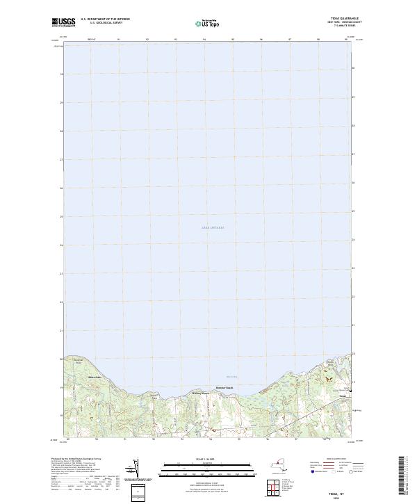
2023 Map of Texas
USGS Topo · Published 2023About this map
Lake Ontario dominates the northern half of this landscape, its waters meeting the shore along Mexico Bay. The shoreline is defined by a series of residential enclaves and seasonal points including Shore Oaks, Hickory Grove, and Dempster Beach. These small settlements are situated between significant coastal marshes and drainages, most notably the Butterfly Swamp which is fed by Butterfly Creek. Inland, the terrain is marked by the small community of Texas, where local genealogy is anchored by the Parker Ramsey Stevens Cem. The map reveals a high concentration of private drives and county routes such as Co Rte 1 and Co Rte 6 that provide access to the waterfront, illustrating the area's development as a contemporary residential and recreational lakeshore district.
Find a feature on this map
29 named features on this map. Tap any name to fly to it.
Don’t see what you’re looking for? This feature index may not catch every label — zoom into the map to look around manually.
Map Details
Editions of this 2023 Texas Map
This is the sole edition of this map. No revisions or reprints were ever made.
Other maps of this area

1895 · Pulaski
USGS Topo · 1:62,500

1900 · Fulton
USGS Topo · 1:62,500

1905 · Mexico
USGS Topo · 1:62,500

1943 · Pulaski
USGS Topo · 1:31,680

1943 · Oswego East
USGS Topo · 1:31,680

1943 · New Haven
USGS Topo · 1:31,680

1943 · Texas
USGS Topo · 1:31,680

1943 · Mexico
USGS Topo · 1:31,680
1943 · Ellisburg
USGS Topo · 1:31,680

1943 · West Of Texas
USGS Topo · 1:31,680