
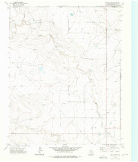
1970 Map of Texline South
USGS Topo · Published 1973About this map
Texline sits at the high-plains intersection of the New Mexico and Texas state line, serving as a critical rail point in the early 1970s. The town's layout is defined by the Fort Worth and Denver railroad, which cuts diagonally through the landscape toward the Gravel Pit on the northeastern edge of the survey. This borderland territory is etched by intermittent drainage systems, most notably Perico Creek and West Rita Blanca Creek, which carve winding paths across the plateau. The transition between Union County and Dallam County is marked by a series of ranching-related infrastructure, including numerous wells and extensive fence lines. Further south, the terrain remains largely open, characterized by the wide basins of Sand Draw and Carrizo Creek, reflecting a landscape dedicated to large-scale land management and sparse settlement near the state boundary.
Find a feature on this map
11 named features on this map. Tap any name to fly to it.
Don’t see what you’re looking for? This feature index may not catch every label — zoom into the map to look around manually.
Map Details
Editions of this 1970 Texline South Map
This is the sole edition of this map. No revisions or reprints were ever made.
Other maps of this area

1954 · Dalhart
USGS Topo · 1:250,000

1958 · Dalhart
USGS Topo · 1:250,000

1962 · Dalhart
USGS Topo · 1:250,000

1970 · Clayton
USGS Topo · 1:24,000

1970 · Clayton SW
USGS Topo · 1:24,000

1970 · Texline North
USGS Topo · 1:24,000

1970 · Sedan
USGS Topo · 1:24,000

1970 · Sedan NE
USGS Topo · 1:24,000

1973 · Corlena
USGS Topo · 1:24,000
1973 · Corlena NW
USGS Topo · 1:24,000