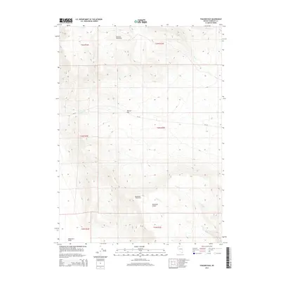
2015 Map of Thacker Pass
USGS Topo · Published 2015About this map
Thacker Pass serves as a critical geographic notch in the high desert of northern Nevada, situated between the Montana Mountains to the north and the Double H Mountains to the south. This 2015 survey illustrates the drainage patterns and rugged relief of this remote corridor, where Thacker Cr flows westward into the expansive Kings River Valley. The landscape is defined by its deep drainages, including Moonshine Canyon and several intermittent streams like Cherry Cr and Pretty Cr. The solitary passage of NV-293 through the pass represents the primary human footprint in a terrain otherwise dominated by the natural topography of Humboldt County. For those studying the Great Basin, the map details the intersection of high peaks and the valley floors that shaped early travel routes through the region.
Find a feature on this map
17 named features on this map. Tap any name to fly to it.
Don’t see what you’re looking for? This feature index may not catch every label — zoom into the map to look around manually.
Map Details
Editions of this 2015 Thacker Pass Map
This is the sole edition of this map. No revisions or reprints were ever made.
Other maps of this area

1882 · Paradise
USGS Topo · 1:250,000

1886 · Disaster
USGS Topo · 1:250,000

1893 · Paradise
USGS Topo · 1:250,000

1893 · Disaster
USGS Topo · 1:250,000

1954 · Vya
USGS Topo · 1:250,000

1955 · McDermitt
USGS Topo · 1:250,000

1958 · Vya
USGS Topo · 1:250,000

1959 · McDermitt
USGS Topo · 1:250,000

1959 · Orovada
USGS Topo · 1:62,500

1959 · Jordan Meadow
USGS Topo · 1:62,500