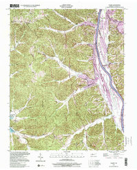
1999 Map of Tharpe
USGS Topo · Published 2001About this map
The Tennessee Ridge Divide carves through this landscape, separating the massive drainage basins of the Cumberland River to the east and the Kentucky Lake reservoir to the west. At the center of this network of wooded hollows and ridges is Tharpe, a small settlement surrounded by family cemeteries that speak to the long-standing community ties in Stewart County. Features like Wilkinson Cem, Sills Cem, and Shemwell Cem are scattered across the high ground between Neville Creek and Barrett Creek.
Find a feature on this map
67 named features on this map. Tap any name to fly to it.
Don’t see what you’re looking for? This feature index may not catch every label — zoom into the map to look around manually.
Map Details
Editions of this 1999 Tharpe Map
This is the sole edition of this map. No revisions or reprints were ever made.
Other maps of this area

1936 · Tharpe
USGS Topo · 1:24,000

1936 · Hamlin
USGS Topo · 1:24,000

1936 · Centerville Landing
USGS Topo · 1:24,000

1936 · Rushing
USGS Topo · 1:24,000

1936 · Standing Rock
USGS Topo · 1:24,000

1936 · Dover
USGS Topo · 1:24,000

1950 · Rushing Creek
USGS Topo · 1:24,000
1950 · Paris Landing
USGS Topo · 1:24,000

1950 · Standing Rock
USGS Topo · 1:24,000
1950 · Hamlin
USGS Topo · 1:24,000