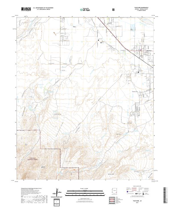
2021 Map of Thatcher
USGS Topo · Published 2021About this map
Gila Valley agriculture and the northern slopes of the Pinaleno Mountains define this landscape south of the Gila River. The settlements of Thatcher, Central, and Pima are linked by W Main St, sitting amidst a complex network of irrigation infrastructure including the Smithville Canal and Robinson Ditch. This system of water management is critical to the valley's character, fed by mountain drainage through features like Frye Cr and Ash Cr. The presence of Eastern Arizona College in Thatcher highlights the town's role as a regional educational hub.
Find a feature on this map
145 named features on this map. Tap any name to fly to it.
Don’t see what you’re looking for? This feature index may not catch every label — zoom into the map to look around manually.
Map Details
Editions of this 2021 Thatcher Map
This is the sole edition of this map. No revisions or reprints were ever made.
Other maps of this area

1942 · Mt. Graham
USGS Topo · 1:62,500

1945 · Mt. Graham
USGS Topo · 1:62,500

1954 · Silver City
USGS Topo · 1:250,000

1958 · Silver City
USGS Topo · 1:250,000

1960 · Thatcher
USGS Topo · 1:62,500

1960 · Safford
USGS Topo · 1:62,500

1962 · Silver City
USGS Topo · 1:250,000

1966 · Artesia
USGS Topo · 1:24,000
1972 · Mt. Graham
USGS Topo · 1:24,000
1972 · Webb Peak
USGS Topo · 1:24,000