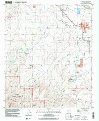
1997 Map of Thatcher
USGS Topo · Published 2002About this map
The Gila River corridor near Thatcher and Central defines this late-twentieth-century landscape, where a complex irrigation system including the Highline Canal and numerous siphons supports the valley's agricultural base. Education and community life are anchored by Eastern Arizona Jr College and the local Rodeo Grounds, while the Union Pacific rail line provides a transit backbone through the settlements.
Find a feature on this map
60 named features on this map. Tap any name to fly to it.
Don’t see what you’re looking for? This feature index may not catch every label — zoom into the map to look around manually.
Map Details
Editions of this 1997 Thatcher Map
This is the sole edition of this map. No revisions or reprints were ever made.
Other maps of this area

1942 · Mt. Graham
USGS Topo · 1:62,500

1945 · Mt. Graham
USGS Topo · 1:62,500

1954 · Silver City
USGS Topo · 1:250,000

1958 · Silver City
USGS Topo · 1:250,000

1960 · Thatcher
USGS Topo · 1:62,500

1960 · Safford
USGS Topo · 1:62,500

1962 · Silver City
USGS Topo · 1:250,000

1966 · Artesia
USGS Topo · 1:24,000
1972 · Mt. Graham
USGS Topo · 1:24,000
1972 · Webb Peak
USGS Topo · 1:24,000