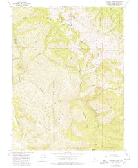
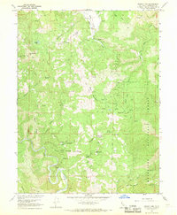
1967 Map of Thatcher Ridge
USGS Topo · Published 1980About this map
The Middle Fork Eel River snakes through the western edge of this Mendocino County landscape, its course monitored by a Gaging Station as it flows past the steep slopes of Grizzly Gulch. High above the river, the interior terrain is defined by a series of prominent northwest-trending divides, including Etsel Ridge, Thatcher Ridge, and the distinctively named Camp Meeting Ridge. The 1967 field check reveals a remote landscape largely contained within the Mendocino National Forest, where human activity is marked by isolated outposts like Barnes Ranch and the small clearing at Hand Flat. Within the Hayshed Basin, water sources such as Skunk Lake and various springs provided critical points of interest for those navigating the network of trails and jeep tracks that cross the high country between Haynes Hill and Thatcher Butte.
Find a feature on this map
43 named features on this map. Tap any name to fly to it.
Don’t see what you’re looking for? This feature index may not catch every label — zoom into the map to look around manually.
Map Details
Editions of this 1967 Thatcher Ridge Map
3 editions found
Other maps of this area

1926 · Covelo
USGS Topo · 1:62,500

1929 · Eden Valley
USGS Topo · 1:62,500

1952 · Hull Mountain
USGS Topo · 1:62,500

1952 · Eden Valley
USGS Topo · 1:62,500

1952 · Covelo
USGS Topo · 1:62,500

1952 · Anthony Peak
USGS Topo · 1:62,500

1957 · Ukiah
USGS Topo · 1:250,000

1960 · Ukiah
USGS Topo · 1:250,000
1966 · Sanhedrin Mtn
USGS Topo · 1:24,000
1966 · Brushy Mtn
USGS Topo · 1:24,000