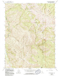
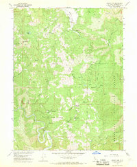
1967 Map of Thatcher Ridge
USGS Topo · Published 1994About this map
Mendocino National Forest defines the character of this rugged Northern California landscape, where the Middle Fork Eel River cuts through the western edge of the quadrangle. The map documents a wilderness dominated by steep elevations and high ridgelines, including the namesake Thatcher Ridge and Etsel Ridge. Within the sprawling Hayshed Basin, the terrain is marked by distinctive natural landmarks like Table Rock and Skunk Rock. Human activity in this remote region is limited to scattered outposts and high-altitude landings such as Hand Flat and the Barpes Ranch, connected by a network of 4WD trails. The intricate drainage system is well-defined, showing the headwaters of Hayshed Creek, Sallady Creek, and Mississippi Creek. This survey captures the Forest Service's management of the area in the late 1960s, prior to later re-mapping in the 1990s, preserving the locations of seasonal seeps and springs vital to local wildlife and early ranching interests.
Find a feature on this map
38 named features on this map. Tap any name to fly to it.
Don’t see what you’re looking for? This feature index may not catch every label — zoom into the map to look around manually.
Map Details
Editions of this 1967 Thatcher Ridge Map
3 editions found
Other maps of this area

1926 · Covelo
USGS Topo · 1:62,500

1929 · Eden Valley
USGS Topo · 1:62,500

1952 · Hull Mountain
USGS Topo · 1:62,500

1952 · Eden Valley
USGS Topo · 1:62,500

1952 · Covelo
USGS Topo · 1:62,500

1952 · Anthony Peak
USGS Topo · 1:62,500

1957 · Ukiah
USGS Topo · 1:250,000

1960 · Ukiah
USGS Topo · 1:250,000
1966 · Sanhedrin Mtn
USGS Topo · 1:24,000
1966 · Brushy Mtn
USGS Topo · 1:24,000