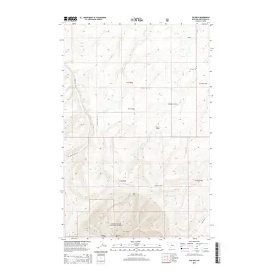
2014 Map of The Arch
USGS Topo · Published 2014About this map
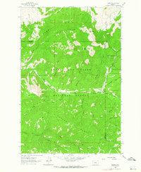
Lewis & Clark National Forest encompasses the southern half of this landscape, where the terrain transitions into the high elevations of Peterson Mtn and the geologic formation known as The Arch. The northern portion of the quadrangle is defined by a complex drainage network, where the waters of Old Geyser Creek and McCarthy Creek have carved deep incisions into the earth. These erosional patterns are most evident in the named landforms of Crow Coulee, Chambers Coulee, and Jackson Coulee, which dictate the local topography.
Find a feature on this map
22 named features on this map. Tap any name to fly to it.
Don’t see what you’re looking for? This feature index may not catch every label — zoom into the map to look around manually.
Map Details
Editions of this 2014 The Arch Map
This is the sole edition of this map. No revisions or reprints were ever made.
Other maps of this area

1890 · Fort Benton
USGS Topo · 1:250,000

1892 · Fort Benton
USGS Topo · 1:250,000

1897 · Fort Benton
USGS Topo · 1:250,000

1954 · Great Falls
USGS Topo · 1:250,000

1957 · Great Falls
USGS Topo · 1:250,000
1961 · Mixes Baldy
USGS Topo · 1:24,000
1961 · The Arch
USGS Topo · 1:24,000
1961 · Limestone Butte
USGS Topo · 1:24,000
1961 · Barker
USGS Topo · 1:24,000

1961 · Barker
USGS Topo · 1:62,500