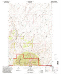
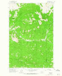
1995 Map of The Arch
USGS Topo · Published 1997About this map
Big Otter Creek winds through the western edge of this Montana landscape, where the high country of the Lewis and Clark National Forest dominates the southern reaches. This 1990s revision, based on photography from the late 1950s, reveals a terrain defined by water-carved coulees and small-scale resource extraction. The presence of the Chambers Mine and Noller Mine suggests the region's enduring connection to mining, while the Mc Carty Grade and a prominent Pipeline trace the modern infrastructure cutting through the Judith Basin. The eponymous landform, The Arch, stands as a primary landmark within the Kings Hill Judith District Ranger District. This map captures a transition between the lower drainage basins of Crow Coulee and the protected mountain wilderness, providing a clear view of the drainage patterns of Old Geyser Creek and Mc Carthy Creek.
Find a feature on this map
17 named features on this map. Tap any name to fly to it.
Don’t see what you’re looking for? This feature index may not catch every label — zoom into the map to look around manually.
Map Details
Editions of this 1995 The Arch Map
This is the sole edition of this map. No revisions or reprints were ever made.
Other maps of this area

1890 · Fort Benton
USGS Topo · 1:250,000

1892 · Fort Benton
USGS Topo · 1:250,000

1897 · Fort Benton
USGS Topo · 1:250,000

1954 · Great Falls
USGS Topo · 1:250,000

1957 · Great Falls
USGS Topo · 1:250,000
1961 · Mixes Baldy
USGS Topo · 1:24,000
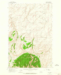
1961 · The Arch
USGS Topo · 1:24,000
1961 · Limestone Butte
USGS Topo · 1:24,000
1961 · Barker
USGS Topo · 1:24,000

1961 · Barker
USGS Topo · 1:62,500