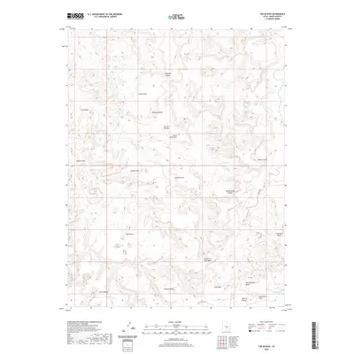
2020 Map of The Blocks
USGS Topo · Published 2020About this map
The Blocks rises as a prominent landmark in this desert landscape of Emery County, Utah, where intricate drainage systems and striking geologic formations dominate the topography. The survey reveals a complex network of seasonal watercourses, including North Fork Coal Wash and Cane Wash, which have carved deep into the terrain to form features like McCarty Canyon and Cow Canyon. Family-named sites and imaginative landmarks provide a record of local nomenclature, from the water management at Reid Neilson Reservoir to the whimsically named Joe and His Dog and Devils Monument.
Find a feature on this map
23 named features on this map. Tap any name to fly to it.
Don’t see what you’re looking for? This feature index may not catch every label — zoom into the map to look around manually.
Map Details
Editions of this 2020 The Blocks Map
This is the sole edition of this map. No revisions or reprints were ever made.
Other maps of this area

1885 · San Rafael
USGS Topo · 1:250,000

1886 · Price River
USGS Topo · 1:250,000

1896 · Price River
USGS Topo · 1:250,000

1952 · San Rafael Knob
USGS Topo · 1:62,500

1953 · Stinking Spring Creek 2 SE
USGS Topo · 1:24,000

1953 · Wilsonville SE
USGS Topo · 1:24,000

1953 · Red Plateau SW
USGS Topo · 1:24,000

1954 · Stinking Spring Creek 1 NW
USGS Topo · 1:24,000

1954 · Stinking Spring Creek 2 SW
USGS Topo · 1:24,000

1954 · Stinking Spring Creek 2 NE
USGS Topo · 1:24,000