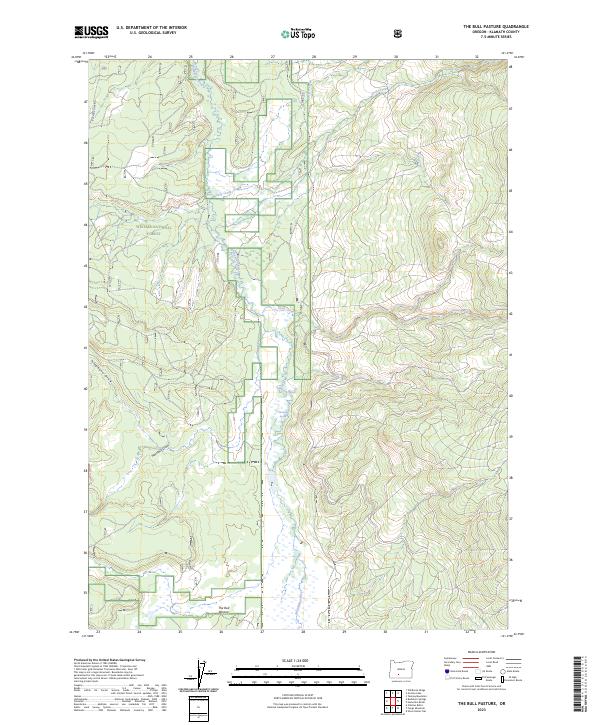
2023 Map of The Bull Pasture
USGS Topo · Published 2023About this map
Winema National Forest encompasses the high country of Klamath County, where the Williamson River carves a path through a landscape of volcanic and timbered terrain. This 2023 survey highlights the hydrological complexity of the region, featuring numerous drainage systems such as Deep Creek, Sand Creek, and Aspen Creek that feed into the primary river valley. The map details a remote interior characterized by natural springs and seasonal waterways, including Wickiup Spring and the aptly named Buckhorn Spring. At the southern end of the sheet, The Bull Pasture serves as a prominent landmark in an area otherwise defined by the topographic relief of Telephone Draw and Haystack Draw. The intricate forest road network documented here reflects a landscape managed for both timber and conservation at the heart of the southern Oregon Cascades.
Find a feature on this map
14 named features on this map. Tap any name to fly to it.
Don’t see what you’re looking for? This feature index may not catch every label — zoom into the map to look around manually.
Map Details
Editions of this 2023 The Bull Pasture Map
This is the sole edition of this map. No revisions or reprints were ever made.
Other maps of this area

1889 · Klamath
USGS Topo · 1:250,000

1894 · Klamath
USGS Topo · 1:250,000

1955 · Klamath Falls
USGS Topo · 1:250,000

1956 · Calimus Butte
USGS Topo · 1:62,500

1957 · Klamath Marsh
USGS Topo · 1:62,500

1958 · Klamath Falls
USGS Topo · 1:250,000

1960 · Fuego Mountain
USGS Topo · 1:62,500

1960 · Yamsay Mountain
USGS Topo · 1:62,500

1980 · Williamson River
USGS Topo · 1:100,000
1988 · Calimus Butte
USGS Topo · 1:24,000