
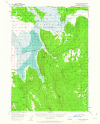
1957 Map of Klamath Marsh
USGS Topo · Published 1959About this map
Klamath Marsh dominates this landscape, a complex wetland environment where the Williamson River winds through a vast expanse of water and marshy terrain. The mid-century survey reveals a working landscape of remote outposts and historical crossings, including the Military Crossing and Lamm Crossing that navigate the marsh's edge. Private life and industry are marked by isolated landmarks such as Kittridge Ranch, Summers Ranch, and Johnson Barn, suggesting a history of cattle ranching and early settlement on the fringes of the Reservation. To the east, the topography rises sharply into the timbered heights of Klamath Ridge and Wind Ridge, cut by features like Shellock Draw. This 1957 record provides a clear view of the hydrological patterns of the Upper Klamath Basin before modern changes, documenting springs like Big Springs and seasonal meadows such as Millhayes Meadow.
Find a feature on this map
40 named features on this map. Tap any name to fly to it.
Don’t see what you’re looking for? This feature index may not catch every label — zoom into the map to look around manually.
Map Details
Editions of this 1957 Klamath Marsh Map
2 editions found
Other maps of this area

1889 · Klamath
USGS Topo · 1:250,000

1894 · Klamath
USGS Topo · 1:250,000

1935 · Chemult
USGS Topo · 1:96,000

1941 · Chemult
USGS Topo · 1:125,000

1955 · Crescent
USGS Topo · 1:250,000

1955 · Klamath Falls
USGS Topo · 1:250,000

1956 · Calimus Butte
USGS Topo · 1:62,500

1957 · Crescent
USGS Topo · 1:250,000

1957 · Chiloquin
USGS Topo · 1:62,500

1957 · Lenz
USGS Topo · 1:62,500