
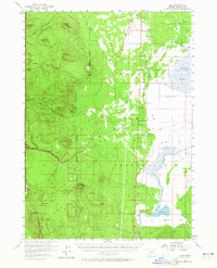
1957 Map of Lenz
USGS Topo · Published 1960About this map
The Klamath Marsh dominates the eastern landscape of this 1957 survey, a vast wetland system where the Williamson River meanders south toward Kirk. This era captures a distinct corridor of rail activity along the Southern Pacific line, which skirts the western edge of the marsh through small stations and sidings like Lenz, Chinchalo, and Fuego. The transition from the aquatic marshland to the forested high ground is sharp, moving westward through the Antelope Desert toward the peaks of Bear Butte and Lookout Butte.
Find a feature on this map
77 named features on this map. Tap any name to fly to it.
Don’t see what you’re looking for? This feature index may not catch every label — zoom into the map to look around manually.
Map Details
Editions of this 1957 Lenz Map
2 editions found
Other maps of this area

1889 · Klamath
USGS Topo · 1:250,000

1891 · Ashland
USGS Topo · 1:250,000

1893 · Ashland
USGS Topo · 1:250,000

1894 · Klamath
USGS Topo · 1:250,000

1897 · Ashland
USGS Topo · 1:250,000

1917 · Diamond Lake
USGS Topo · 1:125,000

1935 · Chemult
USGS Topo · 1:96,000

1941 · Chemult
USGS Topo · 1:125,000

1955 · Pelican Butte
USGS Topo · 1:62,500

1955 · Crescent
USGS Topo · 1:250,000