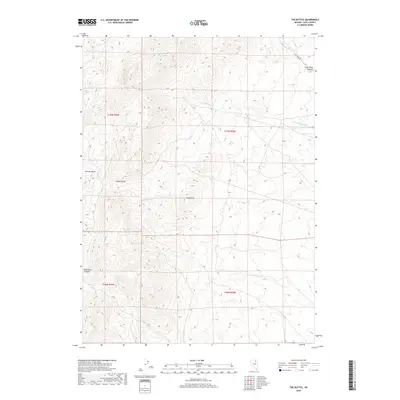
2018 Map of The Buttes
USGS Topo · Published 2018About this map
The Adobe Range dominates the western half of this Elko County landscape, where high-desert drainages carve a complex system of canyons and basins. Named for the distinct topographical formations at the center of the sheet, The Buttes overlook a network of seasonal watercourses including Twelvemile Cr and Willow Cr. To the north, the terrain gives way to Coal Mine Canyon, a name that hints at the region's geological history and resource potential. This 2018 survey reveals a sparsely developed area defined by its natural hydrology and rugged relief, with Coal Mine Rd providing one of the few primary access points into the high country. To the west, Dorsey Basin and Jackstone Canyon illustrate the erosion patterns characteristic of the Nevada interior, where water from sources like Willow Springs is vital to the local environment.
Find a feature on this map
16 named features on this map. Tap any name to fly to it.
Don’t see what you’re looking for? This feature index may not catch every label — zoom into the map to look around manually.
Map Details
Editions of this 2018 The Buttes Map
This is the sole edition of this map. No revisions or reprints were ever made.
Other maps of this area

1955 · Wells
USGS Topo · 1:250,000

1955 · Elko
USGS Topo · 1:250,000

1958 · Wells
USGS Topo · 1:250,000

1958 · Elko
USGS Topo · 1:250,000

1961 · Wells
USGS Topo · 1:250,000

1962 · Elko
USGS Topo · 1:250,000

1962 · Kittridge Springs
USGS Topo · 1:24,000

1962 · Ryndon
USGS Topo · 1:24,000

1962 · Osino
USGS Topo · 1:24,000

1965 · Elko
USGS Topo · 1:250,000