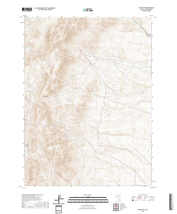
2021 Map of The Buttes
USGS Topo · Published 2021About this map
The high desert landscape of the Adobe Range in Elko County, Nevada, is defined by its dramatic drainage networks and namesake peaks. This 2021 study captures the topographic complexity of The Buttes, where the terrain drops sharply into deep incisions like Coal Mine Canyon and Jackstone Canyon. The area serves as a significant watershed, with Twelvemile Cr and Willow Cr cutting through the slopes, while Willow Springs provides a rare point of surface water in the arid northern basin. Human passage is marked by the winding path of Coal Mine Rd, which navigates the high country between Dorsey Basin and the canyon floors. The map reveals the intricate natural contours of the Great Basin, focusing on the intersection of the range and the various seasonal creeks that define the regional geography.
Find a feature on this map
16 named features on this map. Tap any name to fly to it.
Don’t see what you’re looking for? This feature index may not catch every label — zoom into the map to look around manually.
Map Details
Editions of this 2021 The Buttes Map
This is the sole edition of this map. No revisions or reprints were ever made.
Other maps of this area

1955 · Wells
USGS Topo · 1:250,000

1955 · Elko
USGS Topo · 1:250,000

1958 · Wells
USGS Topo · 1:250,000

1958 · Elko
USGS Topo · 1:250,000

1961 · Wells
USGS Topo · 1:250,000

1962 · Elko
USGS Topo · 1:250,000

1962 · Kittridge Springs
USGS Topo · 1:24,000

1962 · Ryndon
USGS Topo · 1:24,000

1962 · Osino
USGS Topo · 1:24,000

1965 · Elko
USGS Topo · 1:250,000