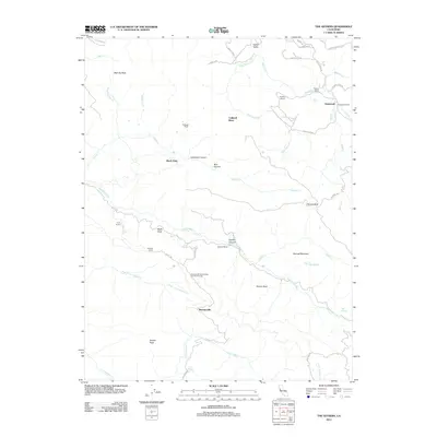
2012 Map of The Geysers
USGS Topo · Published 2012About this map
Mercuryville and the industrial-residential complex of Buckman Mines Housing Unit Number Two define this portion of the Mayacamas Mountains during the early 21st century. The landscape is a network of geothermal activity and mining history, centered around The Geysers and the steep walls of Geyser Canyon. While the area is known for energy production, the map also identifies a legacy of recreation and rural landholding, including the Geysers Resort and several prominent family operations such as the Caldwell Ranch and Binkley Ranch. High elevations like Mahnke Peak and Geyser Peak provide the backdrop for a rugged topography drained by the Big Sulphur Cr and Little Sulphur Cr. The presence of Glenbrook and its associated Glenbrook Resort in the northeast suggests the area's dual identity as both a resource extraction hub and a destination for visitors drawn to the regional springs.
Find a feature on this map
51 named features on this map. Tap any name to fly to it.
Don’t see what you’re looking for? This feature index may not catch every label — zoom into the map to look around manually.
Map Details
Editions of this 2012 The Geysers Map
This is the sole edition of this map. No revisions or reprints were ever made.
Other maps of this area

1920 · Healdsburg
USGS Topo · 1:62,500

1921 · Kelseyville
USGS Topo · 1:62,500

1927 · Calistoga
USGS Topo · 1:62,500

1933 · Healdsburg
USGS Topo · 1:48,000

1940 · Healdsburg
USGS Topo · 1:62,500

1943 · Calistoga
USGS Topo · 1:62,500

1943 · Kelseyville
USGS Topo · 1:62,500

1945 · Calistoga
USGS Topo · 1:62,500

1945 · Lower Lake
USGS Topo · 1:62,500

1947 · Santa Rosa
USGS Topo · 1:250,000