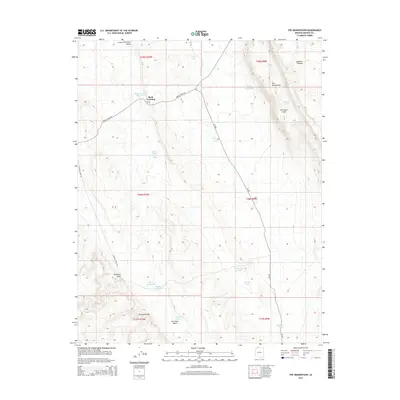
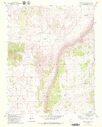
2014 Map of The Grandstand
USGS Topo · Published 2014About this map
Rock Crossing serves as a central landmark in this arid portion of Mohave County, where the landscape is defined by its water management and distinct geologic formations. The area is dominated by the Hurricane Cliffs and the elevated Uinkaret Plateau, with drainage patterns visible through Hurricane Wash and Salaratus Draw. This 2014 survey reveals a network of essential water sources for ranching and survival, including the Rock Crossing Reservoir, Higley Twin Tanks, and Marchant Tank. Transportation through the region follows established routes like the Navajo Trail Rd and Sunshine Trail Rd, which navigate the varying elevations and the broad expanse of the Lower Hurricane Valley. Notable landmarks like The Grandstand provide vertical relief against the system of tanks and ponds, such as Kirk Pond and Toquer Tank, that sustain this high desert environment.
Find a feature on this map
31 named features on this map. Tap any name to fly to it.
Don’t see what you’re looking for? This feature index may not catch every label — zoom into the map to look around manually.
Map Details
Editions of this 2014 The Grandstand Map
This is the sole edition of this map. No revisions or reprints were ever made.
Other maps of this area

1886 · Mt. Trumbull
USGS Topo · 1:250,000

1892 · Mt. Trumbull
USGS Topo · 1:250,000

1953 · Grand Canyon
USGS Topo · 1:250,000
1954 · Lost Spring Mtn
USGS Topo · 1:62,500

1957 · Grand Canyon
USGS Topo · 1:250,000

1958 · Grand Canyon
USGS Topo · 1:250,000

1960 · Grand Canyon
USGS Topo · 1:250,000
1971 · Antelope Knoll
USGS Topo · 1:24,000
1971 · Moriah Knoll
USGS Topo · 1:24,000
1979 · Russell Spring
USGS Topo · 1:24,000