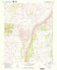
1979 Map of Russell Spring
USGS Topo · Published 1979About this map
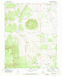
Upper Hurricane Valley and Lower Hurricane Valley define this portion of the Arizona Strip, where the arid landscape is shaped by the drainage of Hurricane Wash and Sunshine Draw. The 1970s terrain is marked by a complex system of water management, evidenced by numerous man-made catchments like J W Spendlove Reservoir, McCullan Reservoir, and the uniquely named Chic Pond. These features, alongside Childers Well, speak to the critical importance of water for livestock and settlement in this remote desert environment. High ground is dominated by prominent landforms such as Diamond Butte and Twin Butte, while Russell Spring provides a rare natural water source tucked beneath the rising elevation of the Cliffs. The presence of Sinkhole Reservoir and Gyp Reservoir further highlights the distinct geology of the Mohave County backcountry.
Find a feature on this map
26 named features on this map. Tap any name to fly to it.
Don’t see what you’re looking for? This feature index may not catch every label — zoom into the map to look around manually.
Map Details
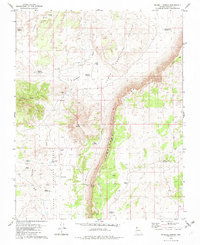
Editions of this 1979 Russell Spring Map
2 editions found
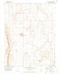
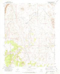
Other maps of this area

1886 · Mt. Trumbull
USGS Topo · 1:250,000

1892 · Mt. Trumbull
USGS Topo · 1:250,000

1953 · Grand Canyon
USGS Topo · 1:250,000

1957 · Grand Canyon
USGS Topo · 1:250,000

1958 · Grand Canyon
USGS Topo · 1:250,000

1960 · Grand Canyon
USGS Topo · 1:250,000

1967 · Mt. Trumbull NW
USGS Topo · 1:24,000
1971 · Antelope Knoll
USGS Topo · 1:24,000
1971 · Moriah Knoll
USGS Topo · 1:24,000
1971 · Poverty Knoll
USGS Topo · 1:24,000