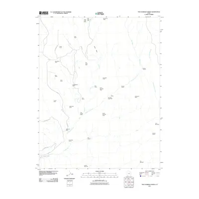
2011 Map of The Guardian Angels
USGS Topo · Published 2011About this map
North Guardian Angel and South Guardian Angel dominate this high-desert landscape within the western section of Zion National Park. This 2011 survey details a complex drainage system where Little Creek flows through Little Creek Valley toward the Little Creek Sinks, while the Left Fork North Creek carves through the legendary geological formation known as The Subway. The map reveals a wilderness of isolated mesas and named peaks, including Greatheart Mesa, Tabernacle Dome, and the Inclined Temple, many of which are accessible only via the winding Kolob Rd or rugged backcountry routes. Local landmarks like The Bishopric and Guardian Angel Pass provide crucial orientation points for navigating the deep canyons and high plateaus. The inclusion of Double Falls and numerous named washes like Grapevine Wash and Wolf Springs Wash highlights the critical role of seasonal water in shaping this arid terrain.
Find a feature on this map
40 named features on this map. Tap any name to fly to it.
Don’t see what you’re looking for? This feature index may not catch every label — zoom into the map to look around manually.
Map Details
Editions of this 2011 The Guardian Angels Map
This is the sole edition of this map. No revisions or reprints were ever made.
Other maps of this area

1885 · St. George
USGS Topo · 1:250,000

1886 · Kanab
USGS Topo · 1:250,000

1891 · St. George
USGS Topo · 1:250,000

1953 · Cedar City
USGS Topo · 1:250,000

1954 · La Verkin 4 NW
USGS Topo · 1:24,000

1954 · Orderville Canyon NW
USGS Topo · 1:24,000

1954 · La Verkin 1 SW
USGS Topo · 1:24,000

1958 · Cedar City
USGS Topo · 1:250,000

1962 · Cedar City
USGS Topo · 1:250,000
1980 · Kolob Arch
USGS Topo · 1:24,000