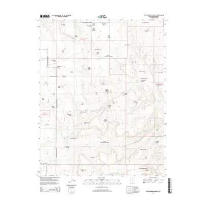
2014 Map of The Guardian Angels
USGS Topo · Published 2014About this map
North Guardian Angel and its southern counterpart dominate the vertical landscape of Zion National Park in this topographic study. The drainage patterns of the Left Fork North Creek and Right Fork North Creek define the complex erosion of the White Cliffs, creating iconic geological features like The Subway and Double Falls. Higher elevations are marked by the broad expanses of the Upper Kolob Plateau and Horse Pasture Plateau, where Sawmill Springs provided a vital water source. The map reveals a transition from the high mesas like Greatheart Mesa down into the deep incisions of Great West Canyon. Significant landmarks including Tabernacle Dome, Pine Valley Peak, and Spendlove Knoll serve as navigational anchors across this varied terrain.
Find a feature on this map
60 named features on this map. Tap any name to fly to it.
Don’t see what you’re looking for? This feature index may not catch every label — zoom into the map to look around manually.
Map Details
Editions of this 2014 The Guardian Angels Map
This is the sole edition of this map. No revisions or reprints were ever made.
Other maps of this area

1885 · St. George
USGS Topo · 1:250,000

1886 · Kanab
USGS Topo · 1:250,000

1891 · St. George
USGS Topo · 1:250,000

1953 · Cedar City
USGS Topo · 1:250,000

1954 · La Verkin 4 NW
USGS Topo · 1:24,000

1954 · Orderville Canyon NW
USGS Topo · 1:24,000

1954 · La Verkin 1 SW
USGS Topo · 1:24,000

1958 · Cedar City
USGS Topo · 1:250,000

1962 · Cedar City
USGS Topo · 1:250,000
1980 · Kolob Arch
USGS Topo · 1:24,000