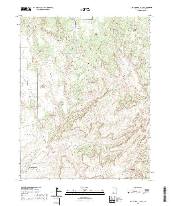
2023 Map of The Guardian Angels
USGS Topo · Published 2023About this map
Zion National Park and the surrounding wilderness areas dominate this corner of Washington County, Utah, where massive geologic formations create a complex vertical landscape. The towering presence of North Guardian Angel and South Guardian Angel anchor the central topography, separated by the Guardian Angel Pass. Deep drainage systems like Wildcat Canyon and Russell Gulch cut through the White Cliffs, feeding into the Left Fork North Creek. In the southwest, the plateau drops away at Smith Mesa and Cave Valley, revealing the route of the Virgin Wild and Scenic River. This survey captures the intricate trail network essential for navigating the high-desert terrain, including the Left Fork (Subway) Trl and the West Rim Trl, which provide access to remote landmarks like The Bishopric and Greatheart Mesa.
Find a feature on this map
56 named features on this map. Tap any name to fly to it.
Don’t see what you’re looking for? This feature index may not catch every label — zoom into the map to look around manually.
Map Details
Editions of this 2023 The Guardian Angels Map
This is the sole edition of this map. No revisions or reprints were ever made.
Other maps of this area

1885 · St. George
USGS Topo · 1:250,000

1886 · Kanab
USGS Topo · 1:250,000

1891 · St. George
USGS Topo · 1:250,000

1953 · Cedar City
USGS Topo · 1:250,000

1954 · La Verkin 4 NW
USGS Topo · 1:24,000

1954 · Orderville Canyon NW
USGS Topo · 1:24,000

1954 · La Verkin 1 SW
USGS Topo · 1:24,000

1958 · Cedar City
USGS Topo · 1:250,000

1962 · Cedar City
USGS Topo · 1:250,000
1980 · Kolob Arch
USGS Topo · 1:24,000