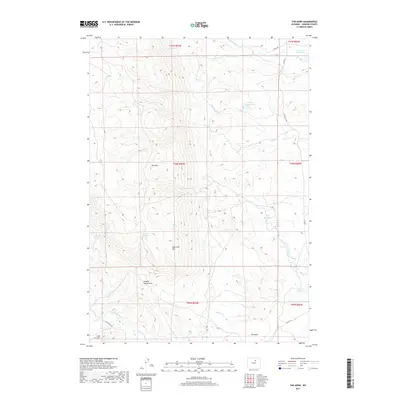
2017 Map of The Horn
USGS Topo · Published 2017About this map
The Horn rises as a prominent landmark in this section of Johnson County, anchoring a landscape defined by an intricate network of water management and high-desert terrain. In this modern survey, the distribution of water is central to the area's utility, marked by the Willow Glen Reservoir in the north and the Horn Cr Reservoir in the south. Irrigation and livestock water sources are distributed throughout the draws and flats, including Frenchy Springs, Dancehall Spring, and the Red Spring. The southern portion of the map is defined by the N Fork Powder River, which flows near The Mesa and Cash Hill. Evidence of local ranching and land use is visible in the naming of topographic features like Charlie House Draw and Specimen Hill, along with the presence of the Horn Cr Ditch and Frances Ditch, reflecting the long-standing agricultural dependence on the creeks draining from the nearby mountains.
Find a feature on this map
32 named features on this map. Tap any name to fly to it.
Don’t see what you’re looking for? This feature index may not catch every label — zoom into the map to look around manually.
Map Details
Editions of this 2017 The Horn Map
This is the sole edition of this map. No revisions or reprints were ever made.
Other maps of this area

1900 · Fort McKinney
USGS Topo · 1:125,000

1903 · Fort McKinney
USGS Topo · 1:125,000

1955 · Sheridan
USGS Topo · 1:250,000

1955 · Arminto
USGS Topo · 1:250,000

1958 · Sheridan
USGS Topo · 1:250,000

1958 · Arminto
USGS Topo · 1:250,000

1961 · Schlict Draw
USGS Topo · 1:24,000

1961 · Hibbard Draw
USGS Topo · 1:24,000

1962 · Sheridan
USGS Topo · 1:250,000

1962 · Arminto
USGS Topo · 1:250,000