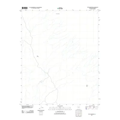
2011 Map of The Landmark
USGS Topo · Published 2011About this map
Tonahokaad Spring serves as a vital water point in this high desert landscape of Coconino County, providing a rare hydrological anchor in an area defined by dry washes and complex drainage patterns. The topography is dominated by the broad expanse of Ward Terrace, which slopes towards the southwest, while the northern horizon is marked by the prominent elevation of The Landmark. These terrain features suggest a region shaped by erosion and intermittent water flow, where landforms like Paiute Trail Point indicate historical transit routes through the plateau. The map details a sparse network of unpaved roads and trails, typical of the undeveloped sections of northern Arizona where elevation and natural landmarks were essential for navigation before extensive modern infrastructure.
Find a feature on this map
4 named features on this map. Tap any name to fly to it.
Don’t see what you’re looking for? This feature index may not catch every label — zoom into the map to look around manually.
Map Details
Editions of this 2011 The Landmark Map
This is the sole edition of this map. No revisions or reprints were ever made.
Other maps of this area

1886 · San Francisco Mtns
USGS Topo · 1:250,000

1891 · San Francisco Mtns
USGS Topo · 1:250,000

1894 · San Francisco Mtns
USGS Topo · 1:250,000

1899 · San Francisco Mtns
USGS Topo · 1:250,000

1947 · Flagstaff
USGS Topo · 1:250,000

1954 · Flagstaff
USGS Topo · 1:250,000

1955 · Black Falls NE
USGS Topo · 1:24,000
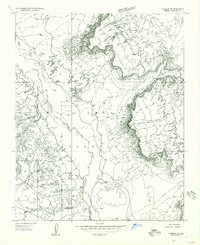
1955 · Cameron SE
USGS Topo · 1:24,000

1955 · Cameron
USGS Topo · 1:62,500

1958 · Flagstaff
USGS Topo · 1:250,000