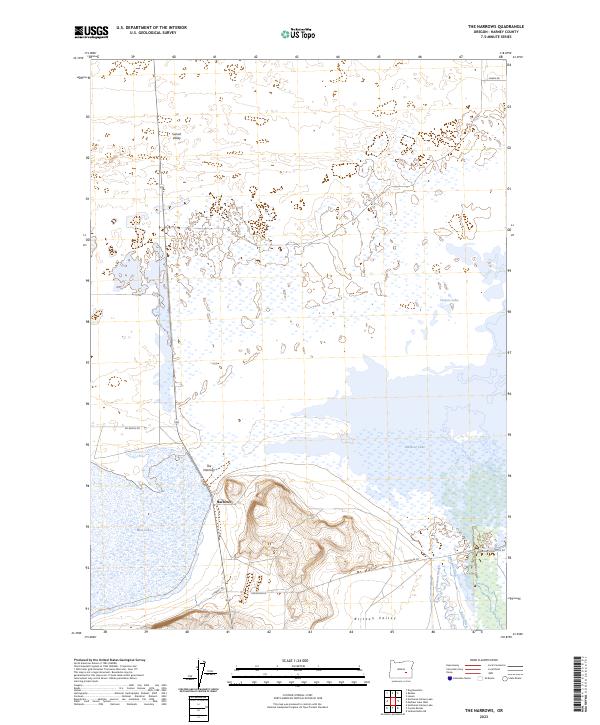
2023 Map of The Narrows
USGS Topo · Published 2023About this map
The Malheur National Wildlife Refuge dominates this section of the Oregon high desert, where a complex network of wetlands and shallow basins defines the local geography. At the heart of this landscape lies The Narrows, a critical geographic pinch point between Malheur Lake and Mud Lake. This area represents a vital hydraulic junction where the waters of the Blitzen Valley meet the expansive lake system. The map documents an intricate system of water management, including the Rineman Ditch, Butte Ditch, and Simmons Slough, illustrating how water is diverted across this arid terrain. Small settlements like Narrows and roads such as OO Ranch Rd and Sodhouse Ln provide the few markers of human habitation in a region characterized by massive seasonal lake fluctuations and expansive valleys like Sunset Valley.
Find a feature on this map
23 named features on this map. Tap any name to fly to it.
Don’t see what you’re looking for? This feature index may not catch every label — zoom into the map to look around manually.
Map Details
Editions of this 2023 The Narrows Map
This is the sole edition of this map. No revisions or reprints were ever made.
Other maps of this area

1955 · Burns
USGS Topo · 1:250,000

1958 · Burns
USGS Topo · 1:250,000

1959 · Burns
USGS Topo · 1:250,000

1959 · Dog Mountain
USGS Topo · 1:62,500

1959 · Lawen
USGS Topo · 1:62,500

1967 · Coyote Buttes
USGS Topo · 1:24,000

1967 · Jackass Butte NE
USGS Topo · 1:24,000

1978 · Malheur Lake
USGS Topo · 1:100,000
1980 · Southeast Harney Lake
USGS Topo · 1:24,000
1990 · The Narrows
USGS Topo · 1:24,000