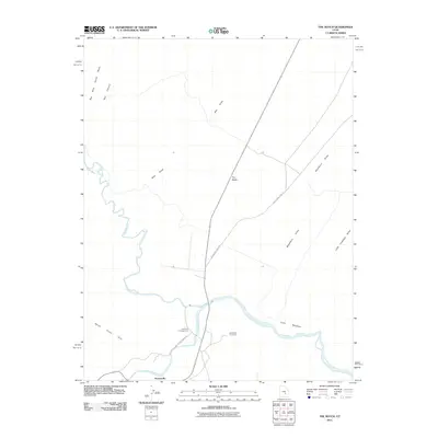
2011 Map of The Notch
USGS Topo · Published 2011About this map
Hanksville serves as the focal point for this 2011 survey, situated at the significant confluence where the Muddy Creek and Fremont River meet to form the Dirty Devil River. This area of Utah is characterized by its complex drainage systems and desert landmarks, including The Notch and the southern edge of Big Wild Horse Mesa. The map details the local road network through labels like Doll House Ranch Rd and Blackburn Draw Rd, which provide access to remote points such as the Red Rock Campground. Genealogists and historians can locate the Hanksville Cemetery and trace the winding paths of seasonal washes like Tank Wash and Well Draw as they cut through the North Pinto Hills. The landscape transition from river valleys to high plateaus like Little Antelope Valley defines the settlement patterns and travel corridors of this desert community.
Find a feature on this map
17 named features on this map. Tap any name to fly to it.
Don’t see what you’re looking for? This feature index may not catch every label — zoom into the map to look around manually.
Map Details
Editions of this 2011 The Notch Map
This is the sole edition of this map. No revisions or reprints were ever made.
Other maps of this area

1885 · San Rafael
USGS Topo · 1:250,000

1952 · Wild Horse
USGS Topo · 1:62,500

1953 · Temple Mtn
USGS Topo · 1:62,500

1954 · Stinking Springs Creek 4 SW
USGS Topo · 1:24,000

1954 · Stinking Spring Creek 3 SE
USGS Topo · 1:24,000

1954 · Stinking Spring Creek 4 SE
USGS Topo · 1:24,000

1954 · Mt. Ellen 2 SE
USGS Topo · 1:24,000

1954 · Mt. Ellen 1 NW
USGS Topo · 1:24,000

1954 · Mt. Ellen 2 NE
USGS Topo · 1:24,000

1954 · Mt. Ellen 1 SW
USGS Topo · 1:24,000