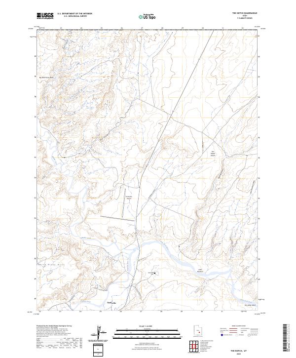
2023 Map of The Notch
USGS Topo · Published 2023About this map
Hanksville serves as a vital focal point where the Fremont River meets Muddy Creek to form the Dirty Devil River. This 2023 survey illustrates the intersection of water and desert life, showing the settlement's infrastructure reaching into the San Rafael Desert. The landscape is defined by dramatic elevation changes, from the heights of Big Wild Horse Mesa and the North Pinto Hills to the drainage of Red Canyon. Local transportation and land use are clearly delineated through named corridors like Doll House Ranch Rd and Hanksville Cemetery Rd, which lead to essential community sites including the Hanksville Cem and the Hanksville Airport. These features highlight the persistence of this outpost within a complex network of washes and draws, including the lengthy Blackburn Draw and the more secluded Little Meadow along the riverbanks.
Find a feature on this map
20 named features on this map. Tap any name to fly to it.
Don’t see what you’re looking for? This feature index may not catch every label — zoom into the map to look around manually.
Map Details
Editions of this 2023 The Notch Map
This is the sole edition of this map. No revisions or reprints were ever made.
Other maps of this area

1885 · San Rafael
USGS Topo · 1:250,000

1952 · Wild Horse
USGS Topo · 1:62,500

1953 · Temple Mtn
USGS Topo · 1:62,500

1954 · Stinking Springs Creek 4 SW
USGS Topo · 1:24,000

1954 · Stinking Spring Creek 3 SE
USGS Topo · 1:24,000

1954 · Stinking Spring Creek 4 SE
USGS Topo · 1:24,000

1954 · Mt. Ellen 2 SE
USGS Topo · 1:24,000

1954 · Mt. Ellen 1 NW
USGS Topo · 1:24,000

1954 · Mt. Ellen 2 NE
USGS Topo · 1:24,000

1954 · Mt. Ellen 1 SW
USGS Topo · 1:24,000