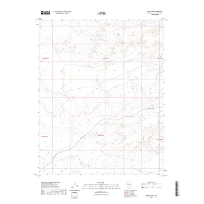
2023 Map of The Pillar NW
USGS Topo · Published 2023About this map
Pinabete Arroyo carves a winding path across this arid landscape in San Juan County, illustrating the intricate drainage patterns characteristic of this high-desert region. The terrain is defined by its topographic relief, with elevation contours revealing the subtle mesas and drainages that shape the local geography. Human presence is marked primarily by Indian Svc Rte 5, a road that traverses the southern and central portions of the quadrangle, providing a vital connection through the Public Land Survey System grids. The map clearly delineates the intersections of multiple townships, including t26n r15w and t25n r15w, which serve as the primary framework for land organization in this part of New Mexico.
Find a feature on this map
8 named features on this map. Tap any name to fly to it.
Don’t see what you’re looking for? This feature index may not catch every label — zoom into the map to look around manually.
Map Details
Editions of this 2023 The Pillar NW Map
This is the sole edition of this map. No revisions or reprints were ever made.
Other maps of this area

1889 · Chaco
USGS Topo · 1:250,000

1892 · Chaco
USGS Topo · 1:250,000

1927 · Sulphur Spring
USGS Topo · 1:96,000

1928 · Kirtland
USGS Topo · 1:125,000

1932 · Kirtland
USGS Topo · 1:125,000

1954 · Shiprock
USGS Topo · 1:250,000

1958 · Shiprock
USGS Topo · 1:250,000

1959 · Shiprock
USGS Topo · 1:250,000
1966 · Newcomb NE
USGS Topo · 1:24,000
1966 · Burnham Trading Post
USGS Topo · 1:24,000