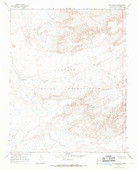
1966 Map of The Pillar NW
USGS Topo · Published 1969About this map
The Navajo Indian Reservation defines this high-desert expanse in the mid-1960s, a landscape shaped by seasonal drainage and mineral exploration. The terrain is characterized by the meandering path of Pinabete Arroyo, which cuts through the arid San Juan County soil. Though largely open and unpopulated, the survey reveals early industrial activity within the reservation boundaries. Evidence of resource extraction is marked by scattered locations of a Drill Hole and several a Well, indicating subsurface exploration during this period. These small technical markers are often the only indications of human footprint in an otherwise vast, topographically complex stretch of New Mexico desert.
Find a feature on this map
4 named features on this map. Tap any name to fly to it.
Don’t see what you’re looking for? This feature index may not catch every label — zoom into the map to look around manually.
Map Details
Editions of this 1966 The Pillar NW Map
This is the sole edition of this map. No revisions or reprints were ever made.
Other maps of this area

1889 · Chaco
USGS Topo · 1:250,000

1892 · Chaco
USGS Topo · 1:250,000

1927 · Sulphur Spring
USGS Topo · 1:96,000

1928 · Kirtland
USGS Topo · 1:125,000

1932 · Kirtland
USGS Topo · 1:125,000

1954 · Shiprock
USGS Topo · 1:250,000

1958 · Shiprock
USGS Topo · 1:250,000

1959 · Shiprock
USGS Topo · 1:250,000
1966 · Newcomb NE
USGS Topo · 1:24,000
1966 · Burnham Trading Post
USGS Topo · 1:24,000