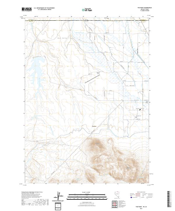
2021 Map of The Point
USGS Topo · Published 2021About this map
Owyhee serves as a central hub in this high-desert landscape, located just south of the Idaho-Nevada border. The area is defined by the intricate irrigation and drainage network of Duck Valley, where Thacker Slough, the Owyhee River, and the Duck Valley Canal support local agriculture and ranching operations. The topography shifts dramatically from the flat valley floor to the rising elevations of the Bull Run Mountains and the prominent landmark known as The Point.
Find a feature on this map
46 named features on this map. Tap any name to fly to it.
Don’t see what you’re looking for? This feature index may not catch every label — zoom into the map to look around manually.
Map Details
Editions of this 2021 The Point Map
This is the sole edition of this map. No revisions or reprints were ever made.
Other maps of this area

1939 · Owyhee
USGS Topo · 1:62,500

1942 · Owyhee
USGS Topo · 1:62,500

1955 · McDermitt
USGS Topo · 1:250,000

1955 · Jordan Valley
USGS Topo · 1:250,000

1957 · Jordan Valley
USGS Topo · 1:250,000

1958 · Jordan Valley
USGS Topo · 1:250,000

1959 · McDermitt
USGS Topo · 1:250,000

1964 · Hat Peak
USGS Topo · 1:62,500
1970 · Ungina Wongo
USGS Topo · 1:24,000

1971 · Juniper Basin SE
USGS Topo · 1:24,000