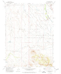
1971 Map of The Point
USGS Topo · Published 1974About this map
The Indian Reservation occupies the central portion of this 1971 survey, showing a landscape defined by water management and high-desert terrain near the Nevada-Idaho border. The Owyhee River flows through the northeast, supported by a network of irrigation works including the Main Canal, the Duck Valley Canal, and the Siphon. Cultural history is noted by the presence of the Chinatown Cem, Smith Cem, and Premo Cem, offering specific points of interest for genealogists tracking early inhabitants of the Duck Valley region.
Find a feature on this map
36 named features on this map. Tap any name to fly to it.
Don’t see what you’re looking for? This feature index may not catch every label — zoom into the map to look around manually.
Map Details
Editions of this 1971 The Point Map
This is the sole edition of this map. No revisions or reprints were ever made.
Other maps of this area

1939 · Owyhee
USGS Topo · 1:62,500

1942 · Owyhee
USGS Topo · 1:62,500

1955 · McDermitt
USGS Topo · 1:250,000

1955 · Jordan Valley
USGS Topo · 1:250,000

1957 · Jordan Valley
USGS Topo · 1:250,000

1958 · Jordan Valley
USGS Topo · 1:250,000

1959 · McDermitt
USGS Topo · 1:250,000

1964 · Hat Peak
USGS Topo · 1:62,500
1970 · Ungina Wongo
USGS Topo · 1:24,000

1971 · Juniper Basin SE
USGS Topo · 1:24,000